Evacuation orders and warnings for Central Coast fires
See a Monterey County evacuation and damage assessment map here:
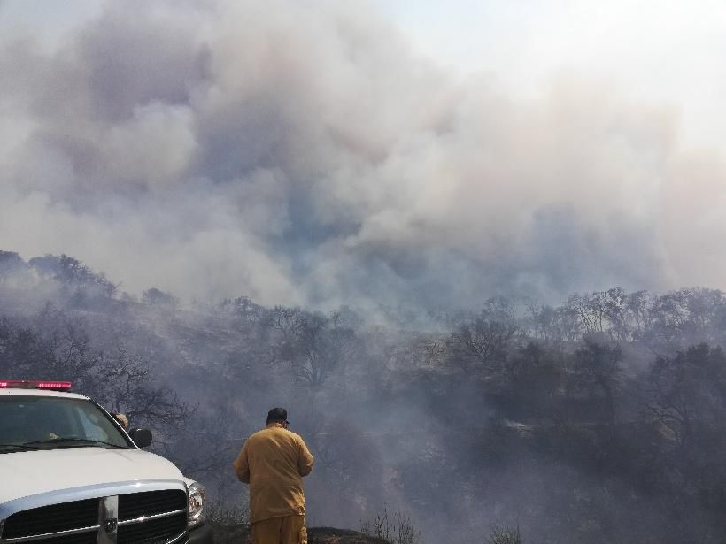
Dolan Fire
Evacuation Orders
- All lifted
Evacuation Warnings
- Zone 27: Santa Lucia Road south to Delventuri Road, Road 5 east to Reliz Canyon.
River Fire
Evacuation Orders
- All lifted
Evacuation Warnings
- All lifted
Carmel Fire
Evacuation Orders
- All lifted
Evacuation Warnings
- All lifted
CZU August Lightning Complex
Santa Cruz County Evacuation Orders
- Waddel Creek, Last Chance Road, Molina Creek Zone CRZ-10C
Santa Cruz County Evacuation Warnings
- All lifted
Lifted Evacuation Orders/Warnings
River and Carmel Fires
- R Zone 1- Pine Canyon Road, Parker Road, Laurel Lane and Trimble Hill Lane
- R Zone 2- South of River Road from Tara Drive to Pine Canyon Road including all roads off Las Palmas Parkway, Ranchito Drive, Indian Springs Road, Redding Drive and Belmont Circle
- R Zone 3- Indian Canyon, Mt. Toro Access Road and San Benancio Road from Troy Lane to Corral de Tierra, including Corral del Cielo Road, Lucie Lane and Covie Lane
- R Zone 4- West of River Road from Parker Road south to Limekiln Road, including Limekiln Road
- R Zone 5- North of San Benancio Road, west of Troy Lane, southeast of Harper Canyon Road, including Harper Canyon Road, Weather Rock Way and Rimrock Canyon Road
- R Zone 6
- R Zone 7- West of River Road from Limekiln Road to Gonzales River Road
- R Zone 8- Areas south of Highway 68 east of San Benancio Road, San Benancio Road south to Harper Canyon Road
- R Zone 9- Areas north of Highway 68 from San Benancio Road east to include all roads off Portola Drive to Veronica Drive/Estoque Place
- R Zone 10- South within intersection of Highway 68 and River Road to Tara Drive and Highway 68 south to San Benancio Road, including the Las Palmas 1 and 117 Drive communities, not including Toro Regional Park
- R Zone 11- Areas north of Highway 68 from Portola Drive and Veronica Drive/Estoque Place east to include all roads off Portola Drive to Creekside Court
- R Zone 13 A- Areas west of River Road to Palo Escrito Peak and south from Gonzales River Road to Puma Road
- R Zone 15- Areas south of Corral de Tierra Road and Underwood Road south to Tassajara Road, not including Corral de Tierra Road and Underwood Road
- Zone 17- Areas south of Highway 68 from San Benancio Road to Laureles Grade, including roads east of Laureles Grade at La Rancheria Road to the south and all areas west of San Benancio Road
- Zone 18- West on Carmel Valley Road from Klondike Canyon Road to Laureles Grade, north on Laureles Grade from Carmel Valley Road to La Rancheria, including communities northeast of Carmel Valley Road and all communities east of Laureles Grade to include Carmel Valley Road, Laureles Grade, La Rancheria and all tributary roads
- Zone 19- West on Carmel Valley Road from Klondike Canyon Road to Pine Tree Lane extending south to Dormody Road and east to Hitchcock Canyon Road and San Clemente Drive, including all communities on Carmel Valley Road and all communities south west of Carmel Valley Road between Klondike Canyon and Pine Tree Lane, including Carmel Valley Village, Robles Del Rio
- Zone 20- Areas and roads south of Highway 68 from Laureles Grade Road extending west to York Road/Camino Saucito and extending south to Carmel Valley Road. All areas and roads north of Carmel Valley Road from Laureles Grade Road extending west to Schetter Road
- Zone 21- West on Carmel Valley Road from Pinetree Lane to Rancho San Carlos. This warning includes all communities south of Carmel Valley Road to include Carmel Valley Road, Rancho San Carlos and all tributary roads
- Zone 24- Areas south of the intersection of East Carmel Valley Road and Arroyo Seco Road to the intersection of Arroyo Seco Road and Elm Avenue, to the intersection of Elm Avenue and Central Avenue. All areas West of the intersections of Elm Avenue and Central Avenue south to the intersection of Central Avenue and Highway 101 to the intersection of Highway 101 and Jolon Road to the intersection of Jolon Road and San Lucas Road. All areas North from the intersection of Jolon Road and San Lucas Road to Junipero Serra Peak. All areas East of Junipero Serra Peak to East Carmel Valley Road. Includes the Arroyo Seco Resort and Recreation Site/Campgrounds
- Zone 13b- All areas and roads east of Carmel Valley Road to Palo Escrito Peak from south of Tassajara Road to Finch Creek
- Zone 14- All areas east of Carmel Valley Road extending south from Finch Creek to Arroyo Seco Road. All areas west of River Road and Romie Road and Arroyo Seco Road south to Elm Avenue and Arroyo Seco Road
- Zone 1- Cachugua Road south of Sky Ranch Road, including Sky Ranch Road and all tributary roads, to Via Cielo and including Via Cielo
- Zone 2- Cachagua Road south from Via Cielo to Summerhill Road, including Via Cielo, Ridgeback Road, Sycamore Road, Summerhill Road and tributaries
- Zone 3- Nason Road south from Cachagua Road
- Zone 4- East of Cachagua Road between Asoleado Drive and Tassajara Road, including Trampa Canyon Road, Comstat Road and tributaries
- Zone 6
- Zone 7- From Cachagua Road north to Klondike Canyon Road on East Carmel Valley Road to include Klondike Canyon road and all roads and communities northeast and southwest of east Carmel Valley Road
- Zone 8AA- The forested unpopulated areas east of San Clemente Reservoir south along Carmel River and Pine Creek to Big Pine Road and Los Padres Reservoir
CZU August Lightning Complex
- Foothills Park to Santa Clara County Line, including Los Trancos Open Space
- South of Moody Road, west of Rancho San Antonio Open Space, west of Black Mountain to Highway 35 (Skyline)
- Monte Bello Open Space Preserve, south of Monte Bello Road to Highway 35 (Skyline)
- Upper Stevens Creek County Park to Highway 35 (Skyline)
- West of Stevens Creek County Park, north of Congress Springs Road, to Highway 35 (Skyline)
- South of Congress Springs Road, west of Sanborn Road, to Highway 35, including Sanborn-Skyline County Park
- South of Lyndon Canyon, west of Highway 17 to Highway 35, including Redwood Estates
- UC Santa Cruz campus (phased reopening determined by chancellor and police chief)
- All of Scotts Valley residents west of State Route17, including unincorporated areas of Scotts Valley. (ZONES: SCO-1, SCO-2, SCO-3, SCO-4, SCO-5, SCO-7, SCO-14, SCO-15, SCO-16, SCO-17, SCO-18, SCO-19, SCO-20, SCO-21, SCO-22, SCO-23, SCO-24, SCO-25)
- The unincorporated areas of Scotts Valley (Zones: CRZ-18B, CRZ 19, CRZ-20)
- Paradise Park (Zones: CRZ-63)
- Cave Gulch area (CRZ-9A)
- Areas of Zayante (Zones: ZAY- 1 – ZAY- 5, ZAY- 6A, ZAY- 7 – ZAY- 17)
- Eastern area of Bear Creek Road (Zones: CRZ- 14A, CRZ- 15, CRZ- 16, CRZ- 18A)
- Areas of Bear Creek Road east of Amber Ridge Loop (Zones: BOU- 27, BOU- 28, BOU-29)
- Mt. Hermon area (Zone: FEL- 05A, and CRZ- 64)
- All areas of Ben Lomond (Zones BEN 2 – BEN 5)
- FEL- 004A, ZAY- 006B
- East edge of Bear Creek (Zones BOU-8A, BOU-13, BOU-25, BOU-26, CRZ-14B)
- BOU-3
- BEN-1B
- CRZ-7
- Zones CRZ-E002A, CRZ-E003A, CRZ-E006B, CRZ-E009ABC, CRZ-E013AB, CRZ-E014ABC, CRZ-E016AB, CRZ-17, CRZ-E063, CRZ-E064
- Zones BOU-E004, BOU-E008A, BOU-E012, BOU-E-013, BOU-E025, BOU-E026, BOU-E027, BOU-E028, BOU-E029
- Zones BEN-E003, BEN-E004, BEN-E005
- Zones FEL-E03A, FEL-E004AB, FEL-E005AB, FEL-E006
- Zones BOU-E006, BOU-E009, BOU-E010, BOU-E014ABC, BOU-E015AB, BOU-E016, BOU-E017, BOU-E018, CRZ-E010A, CRZ-E011C, CRZ-E004AB, CRZ-E05BC
- Zones BOU-E001, BOU-E002, BOU-E005, BOU-E007, BOU-E008B, BOU-E011, BOU-E019, BOU-E023, BOU-E024, BOU-E034, BOU-E035
- Zones CRZ-E011AB, BEN-E001C
- Zones CRZ 2B, CRZ 5A, CRZ 8AB, CRZ 12AB, BOU 32, BOU 38, BOU 39, BOU 40, BOU 41, BOU 42, BOU 43
- Big Basin Way, San Lorenzo Park, Upper State Route 236 area (Zones: CRZ-E013C)
- Zones CRZ-3B and CRZ-10D
- Chalk Mountain Zone CRZ-01
Dolan Fire
- Zone C-Partington: Highway 1 at Anderson Canyon north to Highway 1 at Torre Canyon, west of Highway 1 to the Pacific Ocean, east Highway 1 to North Coast Ridge Road, to include Partington Ridge Road
- Zone A-Big Creek: Highway 1 at Mile Post 35, east to Anderson Peak, south along North Coast Ridge Trail to the intersection with Arroyo Seco Ridge Trail, west through Big Creek State Reserve to intersection of Highway 1 at Mile Post 26 and north along Highway 1 to Mile Post 35
- Zone B1-Lucia North: Highway 1 at Post Mile 26 (Vicente Creek Bridge), south to Highway 1 at entrance to Camaldoli Hermitage, not including road into Hermitage, west of Highway 1 to Pacific Ocean, east of Highway 1 to North Coast Ridge Road/Cone Peak Road
- Zone 14A: West from Palo Escrito Peak to intersection of Martin Road and East Carmel Valley Road to intersection of Carmel Valley oad and Arroyo Seco Road to intersection of Paloma Ridge and Arroyo Seco Road, north along Paloma Ridge to Palo Escrito Peak
- Zone 25: Elm Ave north boundary, east boundary Central Ave to Highway 101 the junction of Jolon Road and San Lucas Road, south boundary top of Zone 28 to Reliz Canyon Road, west boundary Reliz Canyon Road
- Zone 29: San Lucas Road south to Arglye Road, Jolon Road east to Highway 101
- Zone L-Gorda: Highway 1 at Los Burros Road to Salmon Creek Falls including all roads and tributaries within, west of Highway 1 to Pacific Ocean, east of Highway 1 to S. Coast Ridge Road
- Zone M-Salmon Creek: Highway 1 at Salmon Creek Falls sough to the Monterey County Line. Highway 1 west to the Pacific Ocean. Highway 1 east to Salmon Creek Road, including all roads and tributaries within.
- Zone 28: Reliz Canyon east to Jolon Road. Bottom of Zone 25 south to Milpitas Road
- B2/Lucia South Zone- South to Highway 1 at Nacimiento Fergusson Road, including road to Camaldoli Hermitage, Nacimiento Fergusson Road, west of Highway 1 to Pacific Ocean, east of Highway 1 to Cone Peak
- Zone 24: West of Reliz Canyon Road to intersection of Arroyo Seco Road. South of Arroyo Seco Road to intersection of Santa Lucia Trail. East of Santa Lucia Trail to intersection of Bear Mountain Trail. North of Bear Mountain Trail to intersection of Reliz Canyon Road.
- Zone 26: West of Jamesburg Road to intersection with Cahoon Ranch Road. South of Cahoon Ranch Road to Chews Ridge. East of Chews Ridge to where it slopes down to Tassajara Road. East of Tassajara Road to intersection of Tony Trail. East of Tony Trail to intersection of Marble Peak Road. North of Marble Peak Road to intersection of Arroyo Seco Road. North of Arroyo Seco Road to intersection of Jamesburg Road.
- Zone J-Prewitt Ridge Area: South of Nacimiento Fergusson Road, west of South Coast Ridge Road to Prewitt Ridge Road including Alms Ridge
- Zone K-S. Coast Ridge Road: Highway 1 at Mile Marker 15 east to intersection of Prewitt Creek Ridge Road and South Coast Ridge Road , south along South Coast Ridge Road to intersection of Los Burros Road and South Coast Ridge Road, west along Los Burros Road to Highway 1 near Mile Marker 11, including Plasket Ridge Road, San Martin Top and Alder Creek Road